
Hawksbill Crag (Whitaker Point)
Arkansas's most iconic viewpoint — and three hidden waterfalls from the same trailhead.
- Distance
- 3.0 mi RT to Crag · ~4 mi for full loop
- Est. time
- ~2 hr
- Difficulty
- Moderate
- Elevation
- 350 ft
- Area
- Upper Buffalo Wilderness / Cave Mountain Road, Boxley Valley
- Pet friendly
- Yes
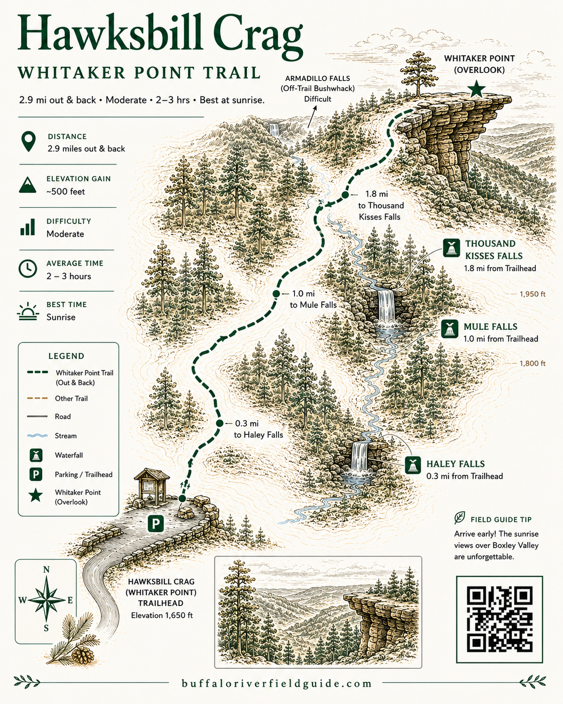
Trail map
Illustrated trail guide
The hike
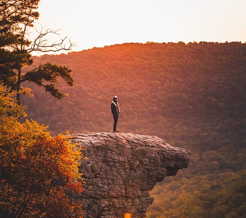
There are viewpoints in Arkansas and then there is Hawksbill Crag. The sandstone outcrop that juts dramatically from the top of a tall bluff high above the Whitaker Creek drainage has become one of the most recognized and photographed spots in the entire state — a natural balcony suspended over one of the deepest and most beautiful wilderness canyons in the Ozarks. Standing at the tip with the Upper Buffalo Wilderness falling away on three sides beneath your feet is one of those genuinely rare experiences that lives up to every photograph you have ever seen of it.
The 3.0-mile round trip trail from the Cave Mountain Road trailhead follows orange blazes through the Upper Buffalo Wilderness, along a dramatic blufftop route with sweeping canyon views, through a passage between giant sandstone blocks, and out to the Crag itself. It is one of the most rewarding moderate hikes in Arkansas — accessible enough for most fit hikers, wild enough to feel like a genuine wilderness experience, and visually spectacular from start to finish.
What most visitors do not know is that the same trailhead hides three waterfalls almost nobody finds. Haley Falls, Mule Trail Falls, and Thousand Kisses Falls are all reachable from the same parking lot on the same day — turning Arkansas's most famous hike into one of the most complete outdoor days in the entire Buffalo River region.
The Secret Most Visitors Miss — The trail to Hawksbill Crag passes directly above Haley Falls, a waterfall with one of the most compelling stories connected to any natural feature in Arkansas. Most hikers walk right past it on their way to the Crag without ever knowing it is there. From the same trailhead, a short loop connects Haley Falls, 31-foot Mule Trail Falls, and 48-foot Thousand Kisses Falls along a scenic bluffline walk through the Upper Buffalo Wilderness. Three waterfalls, one iconic viewpoint, one parking lot, one extraordinary day.
What to Expect — The trail begins across Cave Mountain Road from the parking lot at the Dale Bumpers monument and immediately drops into the Upper Buffalo Wilderness. It crosses a small creek — a natural flow indicator for the waterfalls ahead — climbs briefly to the trailhead register, then switchbacks down the hillside. The wilderness boundary is marked with blue blazes on the trees. Red and purple blazes indicate private property — stay clear of those. The trail levels out and winds through the wilderness, dropping gradually into the Whitaker Creek drainage. In leaf-off season the canyon views begin opening up well before the bluffline. At 1.0 mile the trail reaches a larger creek and a junction — the route to the right leads to Haley Falls and the waterfall loop, while the route to the left continues to Hawksbill Crag.
The blufftop section of the Crag trail is the most dramatic and the most serious. The trail runs close to the edge of a tall bluff with a potentially fatal drop — stay on the marked trail at all times and keep children and dogs under strict control. The trail passes between giant sandstone blocks before the Crag suddenly comes into view ahead. The total distance from the parking lot to the Crag tip is 1.5 miles. The trail does not loop or continue past the Crag — the land beyond is private property. Return the same way you came.
The Three Hidden Waterfalls — Haley Falls: The trail crosses a small creek at 0.4 miles and another larger creek at 1.0 miles — turn right at that second crossing and follow downstream 100 yards to reach Upper Haley Falls. A careful route down the left side of the bluffline leads behind the upper falls and down to the base of the dramatic lower falls. The creek at the trailhead is a reliable flow indicator. Haley Falls carries one of the most powerful stories of any waterfall in Arkansas. In 1999 six-year-old Haley Zega wandered away from her group on this exact trail, drawn toward the waterfall for a closer look. What followed became the largest search and rescue operation in Arkansas history — covered by Dateline NBC and media outlets across the country — three days and two nights alone in the wilderness before Haley was found safe. The waterfall she was drawn to now bears her name permanently. Stand there and take a moment.
Mule Trail Falls (31 feet): From Haley Falls follow the bluffline northwest to Mule Trail Falls at 1.4 miles from the trailhead. Named after a historic mule trail that once ran the full length of Whitaker Creek from the Buffalo River all the way up to Cave Mountain Road — most of that route has long since returned to wilderness but the falls it passes remains. Mule Trail Falls is also the navigation key for the loop return — from its base follow the Lower Fork of Whitaker Creek upstream until it intersects the main trail, then turn left back to the trailhead.
Thousand Kisses Falls (48 feet): Continue along the bluffline from Mule Trail Falls just 0.1 miles further to reach the tallest and most dramatic of the three. A fitting finale to a day that began with the most famous view in Arkansas. The falls drops over a broad bluff face into a sheltered hollow that channels and amplifies the sound of falling water on a good flow day.
Doing the Full Loop — Hawksbill Crag + Three Waterfalls (~4 miles · Moderate · 4–5 hours): Park at the Hawksbill Crag Trailhead and follow the orange-blazed trail across the road. Cross the small creek near the trailhead — if it is running, the falls will have water. At the creek crossing at 0.4 miles you have the option to turn right for a direct route to Mule Trail Falls, or continue straight. At the larger creek junction at 1.0 miles, turn right and follow downstream 100 yards to Haley Falls. Work down to both upper and lower Haley Falls. Follow the bluffline northwest to Mule Trail Falls at 1.4 miles, then continue along the bluffline to Thousand Kisses Falls at 1.5 miles. Return to Mule Trail Falls and follow the Lower Fork of Whitaker Creek upstream to the main trail — turn left back to the trailhead. Add Hawksbill Crag by turning left at the 1.0-mile junction instead of right — 1.5 miles from the trailhead to the Crag tip.
Getting there
From the intersection of Hwy 21 and Hwy 43 in Boxley Valley, head south on Hwy 21 for 1.2 miles. Just before the highway crosses the Buffalo River turn right onto Cave Mountain Road (CR#9560) — a rough dirt road that climbs steeply up Cave Mountain. Pass Cave Mountain Church and cemetery at 5.4 miles, continue past CR#9210, and reach the Hawksbill Crag Trailhead parking lot at 6.0 miles. The trail begins across the road from the parking lot next to the Dale Bumpers monument. Trailhead: Cave Mountain Road, 6.0 miles from Hwy 21 in Boxley Valley. Mule Trail Falls: 35.89363°N, 93.44988°W. Thousand Kisses Falls: 35.89242°N, 93.45053°W. Quad: Boxley. Dogs are allowed on the Hawksbill Crag trail — Upper Buffalo Wilderness is Ozark National Forest land. Check current NPS regulations for sections of the waterfall loop that cross Buffalo National River land. Keep dogs on leash and under strict control near the bluffline — the drop is fatal. Camping is not permitted along the trail or at the Crag.
Pro tips
- ●Family-friendly for kids 5+ who are used to hiking — but extreme caution is required at the top due to sheer, unprotected drop-offs. Hold small hands tight near the Crag
- ●Avoid spring and fall weekends — one of the most crowded trails in Arkansas during peak season
- ●Early morning on any weekday is the best strategy year round for solitude and photography light
- ●The blufftop trail runs close to a potentially fatal drop — stay on the marked trail at all times
- ●The small creek at the trailhead is the best waterfall flow indicator — dry creek means disappointing falls
- ●For waterfalls, visit within 48 hours of significant rain — fall through spring is best
- ●Bring GPS with coordinates loaded before you lose signal on Cave Mountain Road, and a Boxley quad topo as backup
- ●Creek-crossing footwear and trekking poles help on the waterfall loop and steep bluffline sections
- ●Fall color in October and November is extraordinary; rare snow visits are magical
- ●The trail dead ends at the Crag — land beyond is private property, return the way you came
On the same trailhead