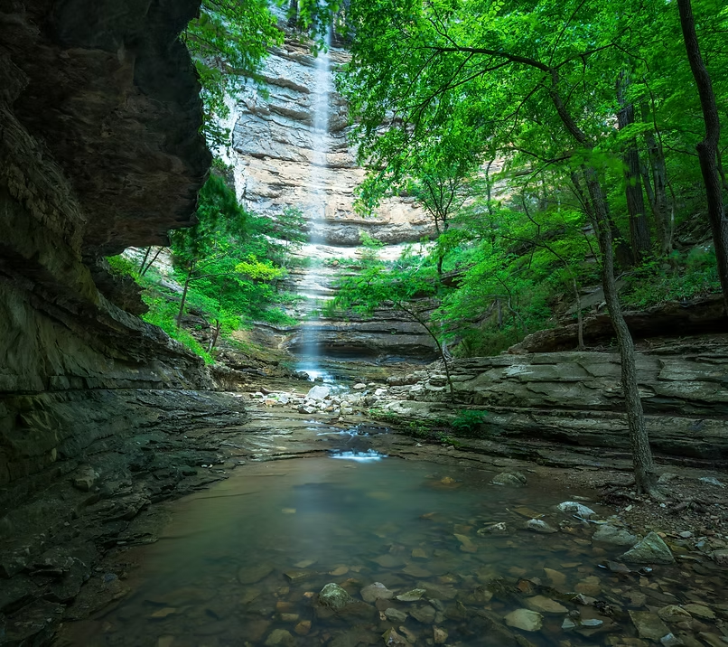
Diamond Falls
At 148 feet, the second-tallest waterfall in Arkansas — and one of the least visited.
- Height
- 148 ft
- Type
- Plunge
- District
- Upper
- Round trip
- 6.0 mi
- Difficulty
- Strenuous
- Best season
- Spring
- Est. time
- 5–7 hours
- Flow-dependent
- Yes
- Pet friendly
- No
- Coordinates
- 36.0813°N, 93.3033°W
Current conditions
- Rain 24h
- 0.00″
- Rain 72h
- 0.00″
- Rain 7d
- 0.11″
Next 3 days (preview)
Live data temporarily unavailable — showing last successful fetch. See full conditions report →
The falls
At 148 feet, Diamond Falls is the second tallest waterfall in Arkansas and one of the most rewarding — and least visited — destinations in the Buffalo National River wilderness. The falls take their name from the way water shatters against a mid-air rock outcropping, spraying outward in a glittering, diamond-like mist before tumbling to the canyon floor below. On a sunny morning after good rain, the effect is genuinely stunning. Unlike its famous neighbor Hemmed-In Hollow, Diamond Falls sees a fraction of the foot traffic. If you're looking for solitude and spectacle in equal measure, this is your waterfall.
Best time to go
Diamond Falls is seasonal. It flows strongest from late winter through late spring (February–May) following significant rainfall. By midsummer it often slows to a trickle or stops entirely. Always check recent precipitation before making the hike — a dry Diamond Falls is still a beautiful canyon, but you'll want to set expectations accordingly.
Getting there
Diamond Falls is accessed from the Compton Trailhead off Highway 43 north of Ponca. Hike the white-blazed Hemmed-In Hollow Trail approximately 2.3 miles to Hemmed-In Hollow Creek. From there, follow the bluffline west above the creek, past the old cedar trees, and through a narrow rock tunnel. Diamond Falls sits just around the corner to the west. Plan on a full day — the trail out of the hollow is steep and relentless. Trailhead GPS: 36.08091, -93.30353 · Diamond Falls GPS: 36.07167, -93.30946.
On the same trailhead